Access and manage your data from the browser on any device
Explore, integrate, and contextualise data from multiple sources.
A limitless store of all your geoscience data
EarthNET Data lake eliminates data silos, contextualises relevant data and makes data accessible. It also facilitates semi-automated data management, quality-control and improvements of underlying datasets that are fed into the AI-assisted applications and workflows in EarthNET.
- DATA INGESTION
- DATA CONTEXTUALISATION
- DATA EXPLORATION
- VERSION-CONTROL
- ACTIVE LEARNING
- OSDU INTEGRATION
Data ingestion
EarthNET Data lake enables connectivity to multiple data sources, so you can ingest your data rapidly and cost-efficiently.
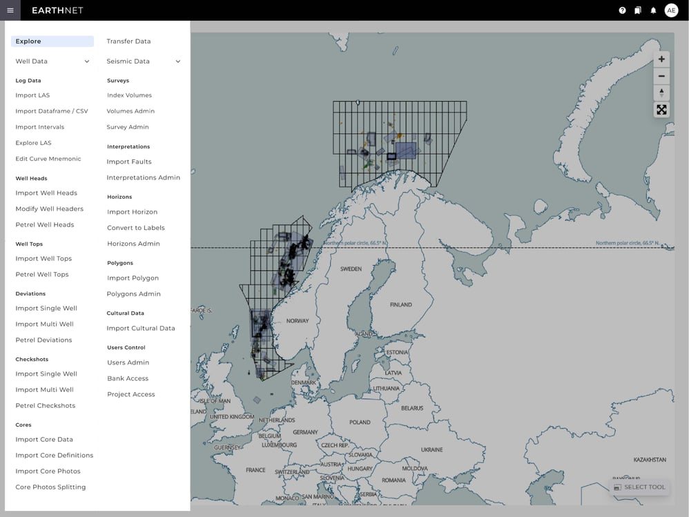
You can import your data from both the OSDU™ Data Platform, legacy corporate databases, and folder-based systems. EarthNET Data Lake supports all main formats for well and seismic data, in addition to image data, lab data, and cultural data.
Data contextualisation
Make your data searchable and accessible using the data contextualisation functionality in EarthNET Data lake.
Contextualised data allows interoperability between different data types, which is the foundation for large-scale integrated data analytics.
Data exploration
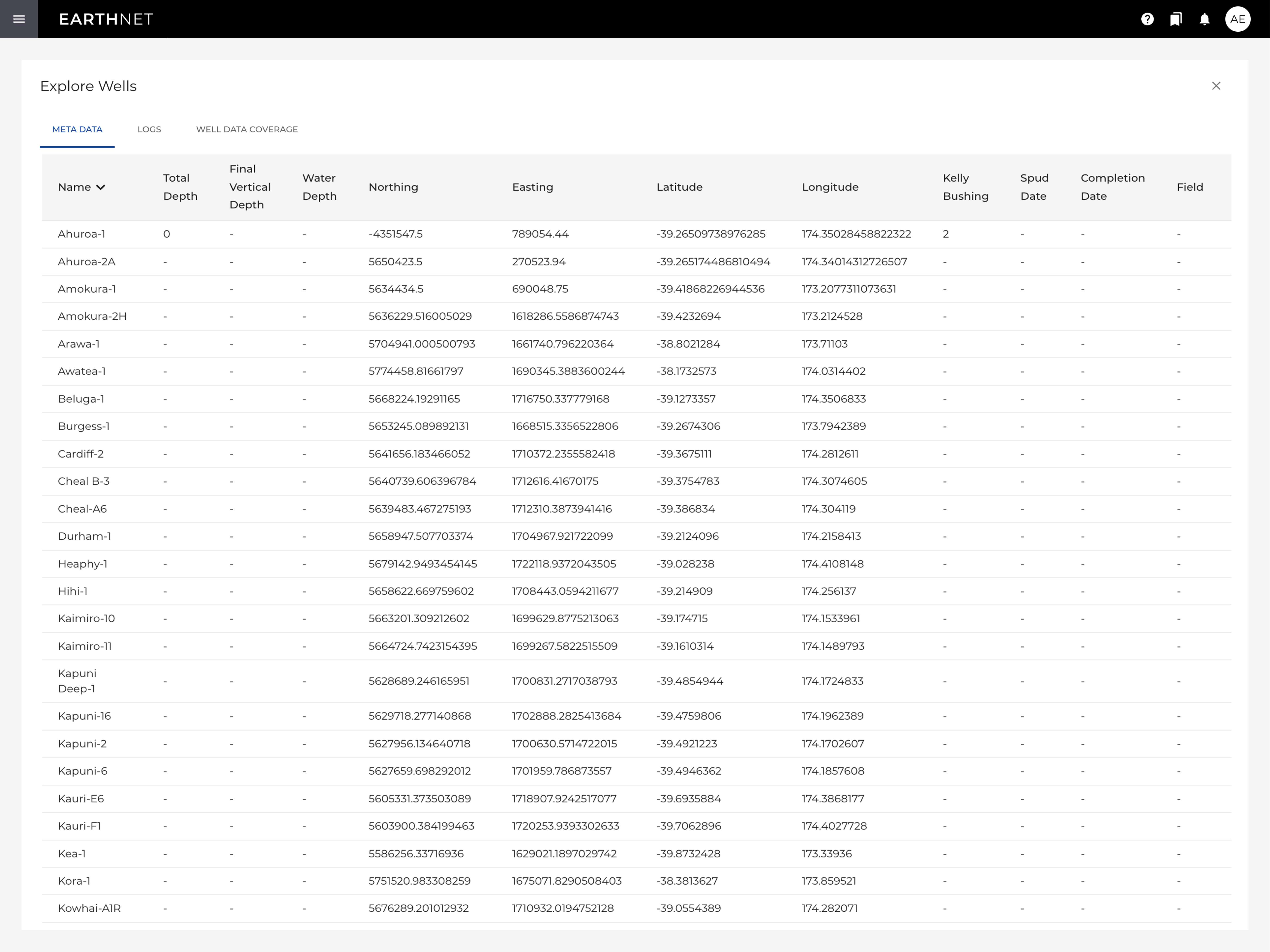
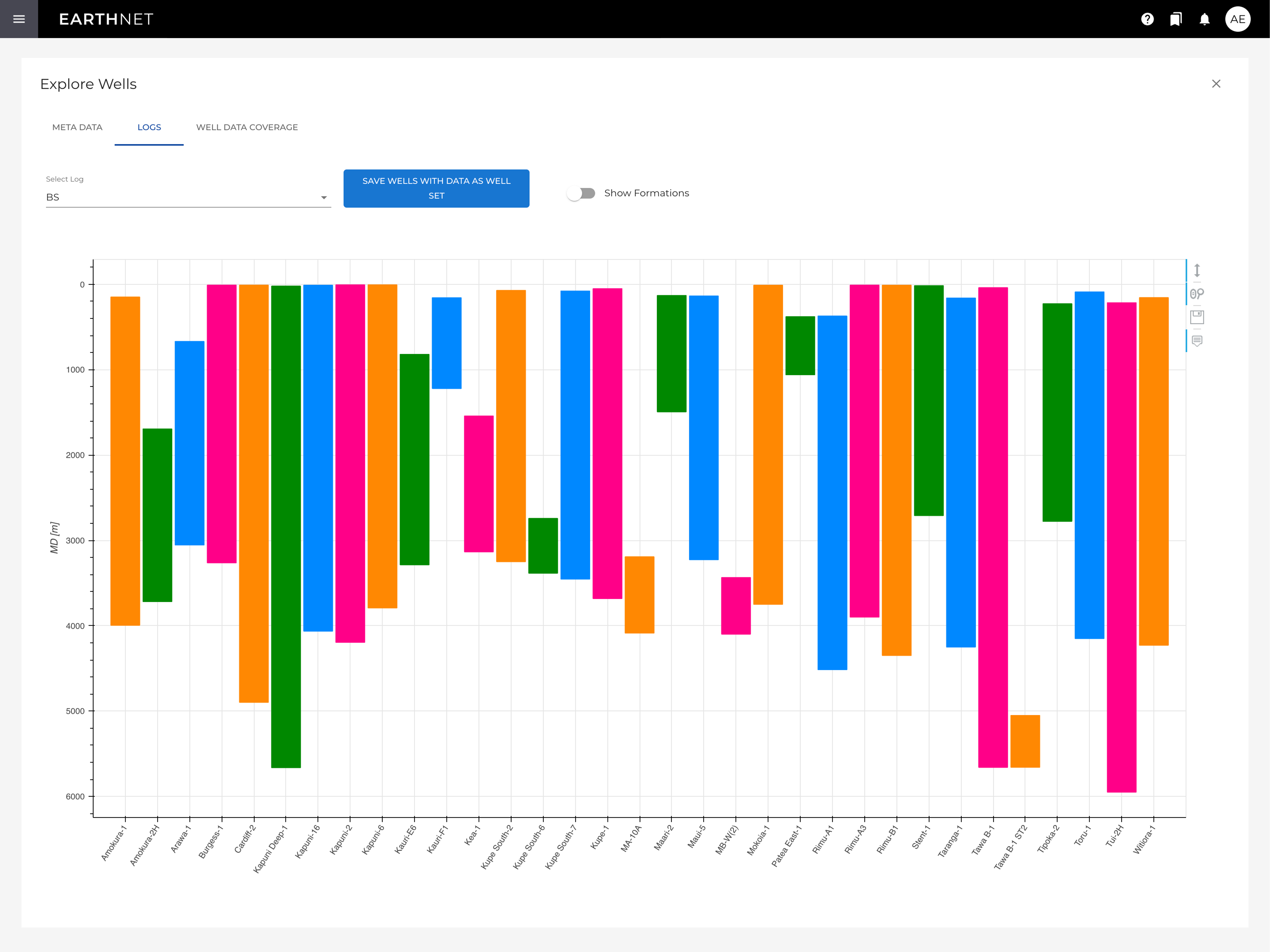
Knowing what data you have available is fundamental for project execution, and with EarthNET Data Lake, all your data is at your fingertips.
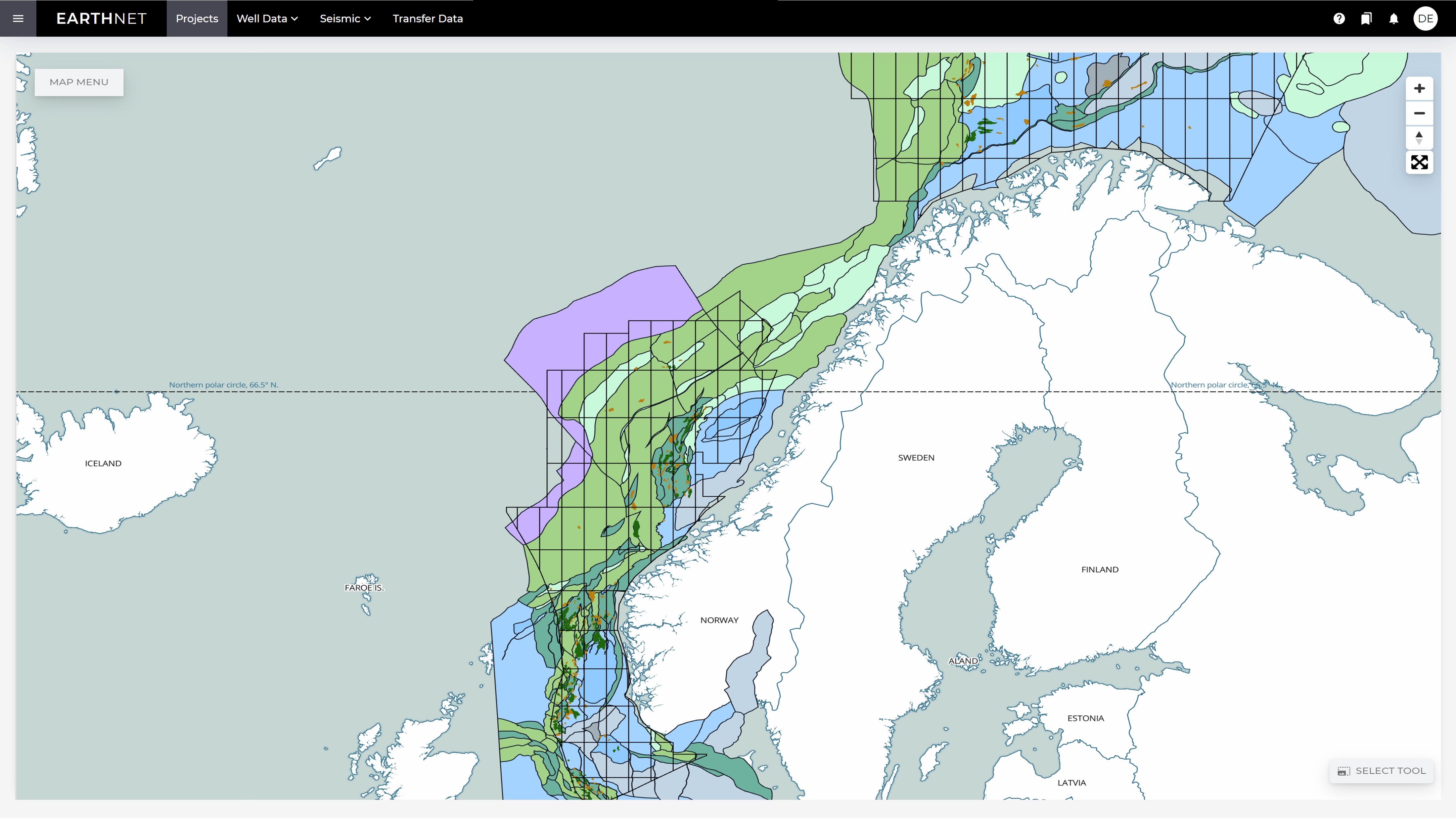
EarthNET Data Lake provides a complete overview of your data through interfaces such as map explorer, well explorer, and other visualisation tools. You can directly visualise data stored in OSDU without duplication.
Version-control
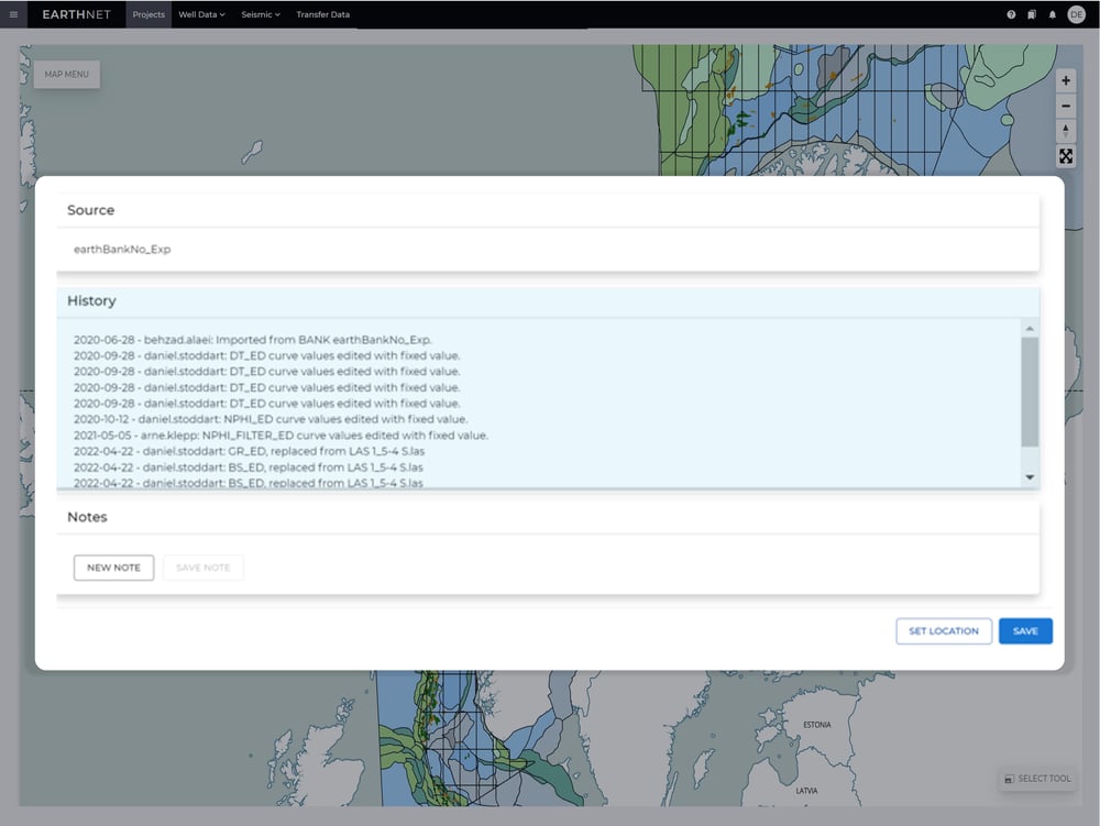
During project work multiple versions of data are created, and it is key to keep track of these to know which one is the currently best version.
Version control of ML models, input data, predictions, and performance metrics, is the foundation for EarthNETs MLOps capabilities. The activity log and model library in EarthNET enables you to maintain data lineage and full reproducibility of your model results.
Continuous improvement of your data
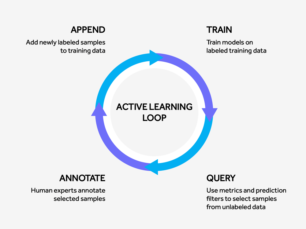
Machine learning models are dynamic in nature, and it is critical to ensure improvement over time. EarthNET solves this challenge through version-control, quality metrics, and iterative improvements of training data.
All models and their metadata are stored in EarthNETs model library and the set of currently best pre-trained models are made easily available to users. Active learning is at the core of all the AI applications in EarthNET, meaning that the models, including input data and output data, continuously improve over time. As a result, you have an evergreen database of inputs, outputs and models.
Integration with the OSDU™ Data Platform
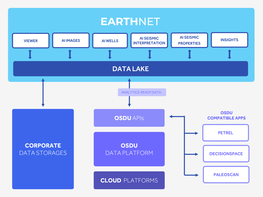
EarthNET Data lake is developed in alignment with the emerging requirements of the OSDU™ Technical Standard, enabling you to push and pull data directly to and from the OSDU™ Data Platform. It also enables seamless integration between EarthNET and software applications from other vendors that are compatible with the OSDU™ Data Platform. This interoperability is key to enable complex workflow utilising multiple software applications.
When executing exploration and reservoir characterisation projects, geoscientists typically use multiple applications from multiple vendors with isolated data storages. Our integration with the OSDU™ Data Platform allows you to liberate your data from these application-silos.
Drastically reduce time spent searching for data
Traditionally, geoscience data is organised in folder structures without metadata stored across multiple data stores connected to specific software products. As a result, geoscientists spend more than half of their time searching for data.
With EarthNET Data lake, all your geoscience data is readily available at your fingertips, so you can spend your time interpreting the data instead of searching for it.
Unlock the full potential your geoscience data
EarthNET Data lake allows you to import, contextualise, explore, and make your data analytics-ready, while continuously improving it. Easily connect your data to other third-party applications through our integration with the OSDU™ Data Platform.
Data can be imported from files and by connecting to third-party data stores, including legacy stores and OSDU
Data lake enables you to index, georeference, and metadata-tag, making your data searchable, filterable, and discoverable
Use the map-based interface in Data lake to view and explore your data in its wider geographical context
Use EarthNETs applications to clean and align your data, making it ready for large scale integrated analytics
Data lake facilitates continuous improvements of the underlying datasets used in the EarthNET applications
Easily push data to the OSDU™ Data Platform, and make it available for third-party applications from other software vendors
"Some try to sell their own hardware for AI platforms in geoscience, and some find excuses for being late due to public cloud dependencies, whereas ESA utilises the client's existing infrastructure and hardware to provide the cloud-native, web-based EarthNET platform."


